Browsing the data
The soil site data is accessible via the Browse data link in the main menu at the top of the page. It provides "views" on to data held in the database which underpins it, and contains all information relating to a particular mission or individual soil site, displayed in an easy to digest form. For further information on what the data consists of, visit the database section.
Quicklinks
Mission view
The top level can be viewed by "Mission" or "All sites".
If "Mission" is chosen (Fig. 1), details of the particular mission is summarised, containing a description of the mission, e.g. "Soil characterisation", the initials of scientists involved, the number of sites and their ids. Clicking on these links takes you to another page which shows details of the sites included in that mission (Fig. 5).
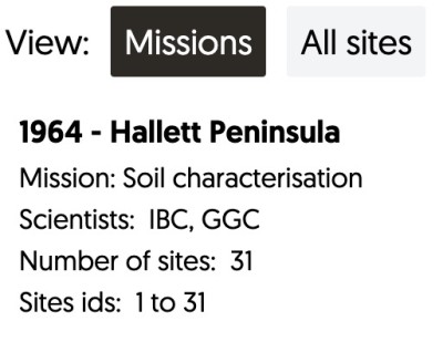
Fig. 1 - Browse data, organised by mission.
All sites view
If "All sites" is chosen (Fig. 2), the individual site numbers are displayed, and can be clicked on to get straight to the site record (Fig. 6).

Fig. 2 - Browse data, showing "All sites".
Map
As well as tabular records, these pages contain interactive maps which display the locations where the samples were taken (Figs. 3 & 4). The map can be zoomed / panned and clicking on the map will display a popup containing all sites at the location clicked (Fig. 3). The sites in the popup can in turn be clicked on to bring up the site record (Fig. 6).

Fig. 3 - Clicking on site(s) on the map displays a popup with sites at the location clicked.
The site data can be accessed by clicking on the records. Figures 4-6 below show some of the various views as you drill down into the data. The map shows the data contained within each view.

Fig. 4 - Browse data, organised by mission.

Fig. 5 - Sites making up a mission.
Site information
Each soil site page contains all available data recorded relating to the site. It includes several sections, however not all sites have all this information, as it may not be relevant or may not have been recorded at the time.
- Site Information
- Location Data
- Climate
- Geology
- Soil
- Profile Description
- Sample Data (including physical data, sample solution chemistry, particle size distribution, clay mineralogy)
- Photos
An example of a soil site information page can be found in Fig. 6, below.


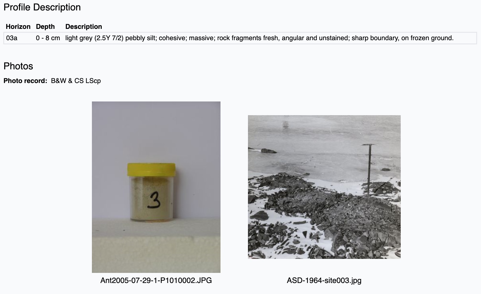
Fig. 6 - Individual site record.
Tips
In the site record pages you will see certain terms or phrases with a dotted underline. Hovering your mouse (or tapping if using a touch device) will show a brief description of the term (Fig. 7).

Fig. 7 - Example of tooltip describing scientific terms or abreviations.