1995

1995-002-Drug-check-before-departure-south.jpg
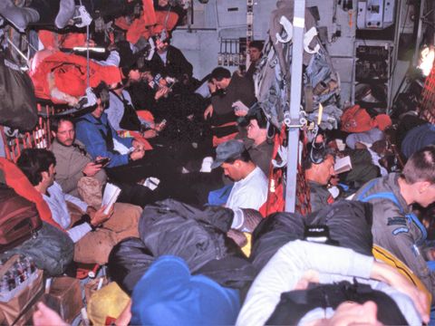
1995-003-A-crowded-herc-flight.jpg

1995-004-View-of-Observation-Hill-and-McMurdo-Station.jpg

1995-005-Communications-radome-at-Arrival-Heights.jpg

1995-006-Castle-Rock.jpg

1995-007-View-of-Erebus-from-Castle-Hill.jpg

1995-012-Permafrost-trial-site-showing-ground-shrinkage.jpg

1995-013-Permafrost-trial-site-at-Scott-Base-showing-ground-shrinkage.jpg

1995-014-Undisturbed-area-at-the-Scott-Base-permafrost-trial-site.jpg

1995-015-Undisturbed-area-at-the-Scott-Base-permafrost-trial-site.jpg

1995-016-D-Campbell-R-MacCulloch-at-the-Scott-Base-soil-climate-site-with-solar-radiation-equipment.jpg

1995-017-D-Campbell-R-MacCulloch-at-the-Scott-Base-soil-climate-site.jpg

1995-019-Helo-loading-for-departure-to-the-Victoria-Valley.jpg

1995-021-Helo-landing-in-the-Barwick-Valley.jpg
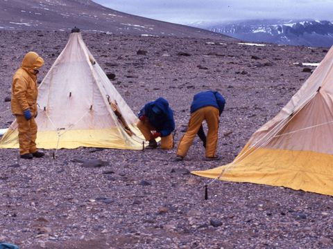
1995-022-Establishing-camp-in-the-Barwick-Valley.jpg

1995-024-A-1965-Barwick-Valley-former-soil-examination-pit-site-partially-infilled.jpg

1995-027-A-patterned-ground-crack-with-boulder-infilling.jpg
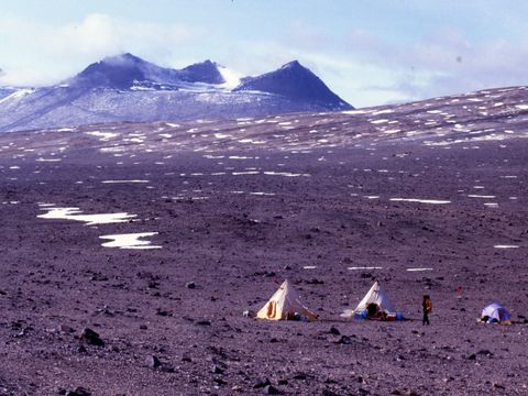
1995-028-Camp-site-in-the-Lower-Barwick-Valley.jpg

1995-031-D-Campbell-R-MacCulloch-walking-in-the-Barwick-Valley-SSSI.jpg

1995-032-A-former-tent-site-in-Barwick-Valley-by-persons-unknown-with-rocks-used-to-weigh-the-tent-down.jpg

1995-033-Debris-at-the-Barwick-Valley-camp-site-from-former-unknown-people-probably-early-1960s.jpg

1995-034-1965-A-former-soil-pit-investigation-site-in-Barwick-Valley.jpg

1995-035-A-former-surface-scratch-soil-examination-site-1965-in-Barwick-Valley.jpg

1995-037-A-1965-A-former-soil-investigation-pit-site-in-Barwick-Valley.jpg

1995-039-A-1965-A-former-soil-pit-investigation-site-in-Barwick-Valley.jpg

1995-040-A-1965-A-former-soil-pit-investigation-site-in-Barwick-Valley.jpg

1995-041-A-1965-A-former-soil-pit-investigation-site-in-Barwick-Valley.jpg
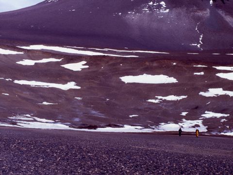
1995-043-One-of-several-large-depressions-in-Barwick-Valley.jpg

1995-044-Lake-Vashka-Barwick-Valley.jpg

1995-045-D-Campbell-at-a-former-unknown-tent-site-identified-by-cleared-surface-stones.jpg
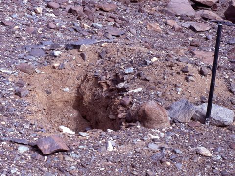
1995-046-A-1965-soil-pit-investigation-site-near-Lake-Vashka-in-Barwick-Valley.jpg

1995-048-Mirror-image-boulder-shapes-Barwick-Valley.jpg

1995-049-Mirror-image-boulder-shapes-showing-former-position-before-overturn-by-wind.jpg

1995-050-A-large-depression-in-Barwick-Valley.jpg

1995-052-Camp-site-at-Lower-Barwick-Valley.jpg

1995-063-A-large-sandstone-erratic-in-Lower-Barwick-Valley.jpg

1995-068-G-Claridge-D-Campbell-at-the-Vanda-LICL-soil-leaching-trial-site.jpg

1995-073-G-Claridge-D-Campbell-R-MacCulloch-at-the-Vanda-LiCl-trial-site.jpg

1995-074-The-Vanda-treading-trial-site-one-year-later.jpg

1995-076-View-of-camp-site-at-the-mouth-of-Sessrumnir-Valley-and-Wright-Upper-Glacier.jpg

1995-078-D-Campbell-collecting-snow-at-Sessrumnir-Valley-camp-site.jpg

1995-080-Former-1972-soil-pit-investigation-site.jpg

1995-081-Sandstone-formation-in-Sessrumnir-Valley.jpg
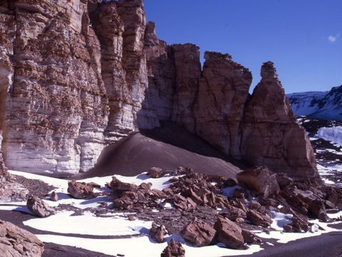
1995-085-Sandstone-cliffs-in-Sessrumnir-Valley.jpg

1995-086-View-of-Wright-Upper-Glacier-and-ice-falls.jpg

1995-091-View-of-Sessrumnir-Valley-camp-site-Mt-Boreas-Mt-Aeolus.jpg

1995-92-View-from-Sessrumnir-across-Wright-Valley-to-Mt-Boreas-Mt-Aeolus.jpg

1995-094-Heaved-sandstone-bedrock-forming-a-rubble-pile-Sessrumnir-Valley.jpg
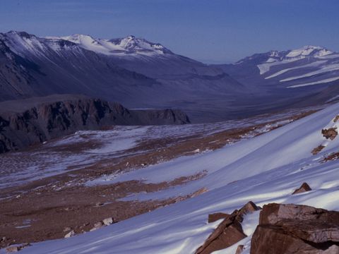
1995-095-View-of-Wright-Valley-to-the-east.jpg

1995-096-View-of-the-Dias-Wright-Valley.jpg

1995-99-View-of-the-Labyrinth-Wright-Upper-Glacier-from-Sessrumnir-Valley.jpg

1995-100-Site-of-a-soil-pit-in-Sessrumnir-Valley-by-unknown-persons-with-subsoil-material-left-on-top.jpg

1995-103-A-1972-A-former-soil-examination-site.jpg

1995-104-A-1972-A-former-soil-examination-pit-site.jpg
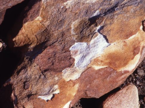
1995-106-weathering-by-differential-exfoliation-on-sandstone-Sessrumnir-Valley.jpg

1995-107-A-1972-A-former-soil-examination-pit-site-Sessrumnir-Valley.jpg
1995-108-Beacon-sandstone-cliffs-in-Sessrumnir-Valley.jpg
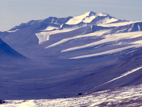
1995-117-View-of-Lower-Wright-Valley.jpg

1995-120-Desert-pavement-on-an-ancient-surface-in-Sessrumnir-Valley.jpg

1995-121-D-Campbell-R-MacCulloch-on-an-old-pavement-surface-in-Sessrumnir-Valley.jpg

1995-127-Camp-site-view-at-Sessrumnir-Valley.jpg
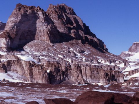
1995-129-Inland-Forts-Asgard-Range-at-Sessrumnir-Valley.jpg

1995-130-A-little-thaw-water-on-a-flat-rock-surface-Sessrumnir-Valley.jpg

1995-139-I-Campbell-in-a-soil-pit-in-the-Convoy-Range-near-Mt-Brooke.jpg

1995-142-Mt-Brooke-camp-site-Convoy-Range.jpg

1995-143-Mt-Brooke-camp-site.jpg
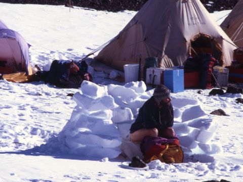
1995-144-D-Campbell-at-Mt-Brooke-camp-a-posed-picture-to-demonstrate-life-in-the-Antarctic.jpg

1995-146-A-high-ridge-near-Mt-Brooke-showing-wind-sculpted-landscspe.jpg

1995-147-Mt-Brooke-area-showing-a-wind-modified-ridge-landscape.jpg

1995-148-Carapace-Nunatak-from-Mt-Brooke.jpg

1995-152-A-wind-rippled-landsurface-near-Mt-Brooke-Convoy-Range.jpg

1995-153-Downslope-wind-flow-direction-shown-by-snow-patterns-Mt-Brooke-area.jpg

1995-161-R-MacCulloch-D-Campbell-G-Claridge-at-a-Permafrost-drill-site-Mt-Brooke-area.jpg

1995-162-Salt-accumulation-beneath-a-surface-stone-near-Mt-Brooke.jpg

1995-169-I-Campbell-at-a-dry-frozen-soil-site-near-Mt-Brooke.jpg

1995-171-R-MacCulloch-at-the-soil-thermal-investigation-site-near-Mt-Brooke.jpg

1995-173-R-MacCulloch-D-Campbell-at-the-soil-thermal-investigation-site-with-bad-weather-coming-in.jpg

1995-175-Snowy-weather-at-the-Mt-Brooke-camp-site.jpg

1995-176-The-Mt-Brooke-camp-site.jpg

1995-178-D-Campbell-R-MacCulloch-with-worsening-weather-at-the-soil-thermal-investigation-site-near-Mt-Brooke.jpg

1995-180-Almost-whiteout-conditions-at-the-Mt-Brooke-soil-thermal-investigation-site.jpg

1995-182-D-Campbell-R-MacCulloch-at-the-soil-thermal-investigation-site-near-Mt-Brooke.jpg

1995-204-Camp-site-at-Mt-Brooke.jpg

1995-205-Thawing-conditions-after-the-storm-at-Mt-Brooke.jpg

1995-209-Camp-site-at-Mt-Brooke.jpg

1995-217-I-Campbell-at-the-tent-Mt-Brooke-camp-site.jpg

1995-222-I-Campbell-at-the-tent-Mt-Brooke-camp-site.jpg

1995-223-Wind-abraided-tuffaceous-rock-at-the-Mt-Brooke-area.jpg

1995-225-Tuffaceous-rock-near-Mt-Brooke.jpg

1995-230-A-dolerite-dike-near-Mt-Brooke.jpg

1995-231-Wind-rippled-landscape-in-the-Convoy-Range.jpg

1995-233-Wind-rippled-landscape-in-the-Convoy-Range.jpg

1995-236-Helo-for-departure-from-the-Mt-Brooke-area.jpg

1995-239-D-Campbell-R-MacCulloch-pitching-the-tent-in-Northwind-Valley.jpg

1995-243-Weathering-dolerite-rock-in-Northwind-Valley.jpg

1995-244-Northwind-Valley-camp-site.jpg

1995-246-Northwind-Valley-Northwind-Glacier-view.jpg

1995-251-Yellow-lichens-at-Northwind-Valley.jpg

1995-255-Inside-the-cooking-tent-at-Northwind-Valley-camp.jpg

1995-261-I-Campbell-at-a-dry-permafrost-soil-site-Northwind-Valley.jpg

1995-262-Dolerite-rock-sculpture.jpg

1995-265-Northwind-Valley-view.jpg

1995-274-Dolerite-outcrops-on-the-east-side-of-Northwind-Valley.jpg

1995-277-View-of-terrain-towards-the-head-of-Northwind-Valley.jpg

1995-278-D-Campbell-R-MacCulloch-at-a-soil-thermal-properties-investigation-site-Northwind-Valley.jpg

1995-279-D-Campbell-at-the-Northwind-Valley-soil-thermal-investigation-site.jpg

1995-281-Determining-soil-bulk-density-for-the-soil-at-Northwind-valley-investigation-site.jpg

1995-282-I-Campbell-describing-a-dry-frozen-old-soil-at-Northwind-Valley.jpg

1995-285-Weathered-sandstone-boulders-at-Northwind-Valley.jpg

1995-286-Soil-moistening-at-the-edge-of-a-retreating-snow-accumulation-at-Northwind-Valley.jpg

1995-287I-Campbell-amongst-sandstone-boulders-at-Northwind-Valley.jpg

1995-289-Salt-accumulation-beneath-stones-on-a-soil-surface-at-Northwind-Valley.jpg
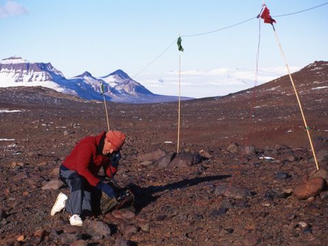
1995-295-I-Campbell-doing-radio-communication-with-Scott-Base-at-Northwind-Valley.jpg

1995-297-Permafrost-polygons-in-Northwind-Valley.jpg

1995-304-Strongly-weathered-dolerite-on-an-ancient-surface-at-Northwind-Valley.jpg

1995-306-Departure-time-from-Northwind-Valley-camp.jpg
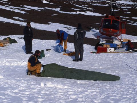
1995-307-Packing-up-camp-at-Northwind-Valley.jpg

1995-310-G-Claridge-D-Campbell-R-MacCulloch.-G-Claridges-final-day-in-the-field.jpg

1995-312-Datalogger-retrieval-from-Marble-Point.jpg

1995-313-1990-Marble-Point-soil-pit-recovery-examination.jpg

1995-314-Disturbance-recovery-examination-at-Marble-Point.jpg

1995-315-1990-Marble-Point-soil-pit-recovery-examination.jpg

1995-317-1990-Marble-Point-soil-pit-recovery-examination.jpg

1995-321-Vehicle-track-made-in-1990-at-Marble-Point.jpg

1995-326-View-of-Mt-Erebus.jpg

1995-327-The-road-between-Scott-Base-and-McMurdo.jpg

1995-328-Frozen-water-from-a-culvert.jpg

1995-329-Stored-waste-at-McMurdo-Station.jpg

1995-333-The-permafrost-experimental-site-at-Scott-Base.jpg

1995-334-The-kitchen-at-Scott-Base.jpg

1995-336-Mt-Erebus-from-the-presssure-ridges.jpg

1995-338-McMurdo-Station-from-on-the-ice.jpg

1995-340-The-Royal-Society-Range-from-the-ice.jpg

1995-Dec-001-sea-ice-pattern-near-White-Island.jpg

1995-Dec-002-A-fragmented-boulder-that-may-be-zeolite.jpg

1995-Dec-005-The-shore-area-at-White-Island.jpg

1995-Dec-006-The-sea-ice-edge-at-White-Island.jpg
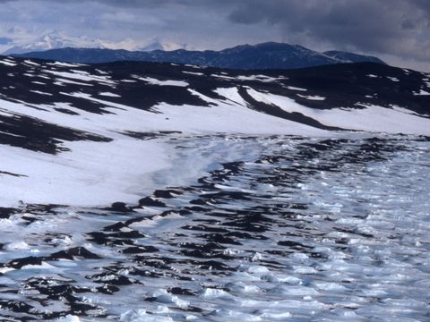
1995-Dec-009-Sea-ice-edge-at-White-Island.jpg

1995-Dec-011-Ice-thaw-adjacent-to-the-dirty-ice-area.jpg

1995-Dec-013-Ice-thaw-patterns-near-the-dirty-ice-area-McMurdo-Sound.jpg

1995-Dec-014-Part-of-the-dirty-ice-area.jpg

1995-Dec-015-Aerial-view-of-the-dirty-ice-McMurdo-Sound.jpg

1995-Dec-016-View-into-lower-taylor-Valley.jpg

1995-Dec-017-Helo-refuel-stop-at-Marble-Point.jpg

1995-Dec-018-Edge-of-the-Wilson-Piedmont-Glacier-in-Wright-Valley.jpg

1995-Dec-022-Edge-of-the-Wilson-Piedmont-Glacier-in-Wright-Valley.jpg

1995-Dec-023-Edge-of-the-Wilson-Piedmont-Glacier-in-Wright-Valley.jpg

1995-Dec-025-Edge-of-the-Wilson-Piedmont-Glacier-in-Wright-Valley.jpg

1995-Dec-026-Edge-of-the-Wilson-Piedmont-Glacier-in-Wright-Valley.jpg

1995-Dec-027-Edge-of-the-Wilson-Piedmont-Glacier-in-lower-Wright-Valley-source-of-the-Onyx-River.jpg
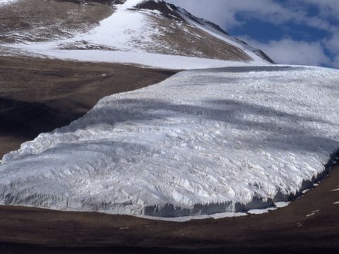
1995-Dec-029-Aerial-view-of-the-Meserve-Glacier-Wright-Valley.jpg

1995-Dec-030-The-former-Vanda-Station-site.jpg

1995-Dec-031-The-LiCl-soil-leaching-site-near-Vanda-Station.jpg

1995-Dec-032-The-Vanda-soil-treading-trial-site-2-years-after-its-formation.jpg

1995-Dec-033-The-LiCL-soil-leaching-trial-site-near-Vand-Station.jpg

1995-Dec-037-Fuel-contaminated-soil-at-Vanda-Station.jpg

1995-Dec-038-Forever-vehicle-tracks-on-the-valley-floor-near-Vanda-Station.jpg

1995-Dec-040-Lamprophyre-dikes-and-moraine-boulders-on-the-Wright-Valley-floor-near-Vanda-Station.jpg

1995-Dec-041-The-new-location-for-Vanda-Station.jpg

1995-Dec-042-Lamprophyre-dikes-on-the-valley-floor-near-Vanda-Station.jpg

1995-Dec-043-A-disaggregated-boulder-near-Vanda-Station.jpg

1995-Dec-044-Bedrock-weathering-near-Vanda-Station.jpg

1995-Dec-046-Discoloured-soil-area-near-Vanda-Station.jpg

1995-Dec-047-An-odd-shaped-ventiform-rock-near-Vanda-Station.jpg

1995-Dec-049-Fuel-contaminated-soil-near-Vanda-Station.jpg

1995-Dec-050-The-datalogger-soil-temperature-recording-site-by-the-LiCl-leaching-site-at-Vanda.jpg

1995-Dec-051-The-LiCl-leaching-trial-site-on-the-north-side-of-Lake-Vanda.jpg

1995-Dec-052-Permafrost-experimental-site-at-Scott-Base.jpg

1995-Dec-054-Mt-Erebus.jpg

1995-Dec-056-Fuel-storage-tanks-at-McMurdo.jpg

1995-Dec-057-Crarey-Lab-building-at-McMurdo-Station.jpg

1995-Dec-059-Unstable-peremafrost-thawed-land-at-McMurdo.jpg

1995-Dec-062-McMurdo-outdoor-storage.jpg

1995-Dec-063-Observation-Hill-and-Mt-Erebus.jpg

1995-Dec-064-Scott-Base-view.jpg

1995-Dec-065-Arrival-Heights.jpg
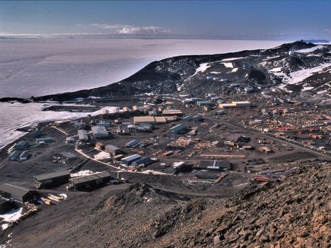
1995-Dec-066-View-of-McMurdo-Station.jpg

1995-Dec-067-McMurdo-shuttle-bus.jpg

1995-Dec-068-Accelerated-tream-runoff-at-McMurdo.jpg
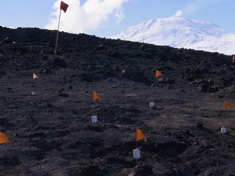
1995-Dec-070-Scott-Base-permafrost-experiment-site.jpg

1995-Dec-073-Mt-Erebus.jpg
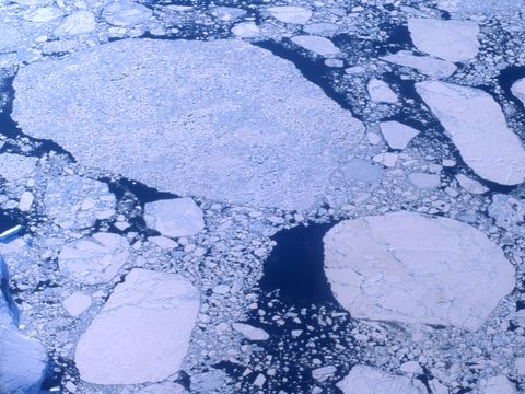
1995-Dec-074-pancake-ice.jpg

1995-Dec-075-Mt-Melbourne.jpg