1999

1999-001-I-Campbell-D-Sheppard-R-Paetzold-M-Balks-D-Saul-J-Kimble-before-Christchurch-departure..jpg

1999-003-Sea-ice-from-high-altitude.jpg

1999-008-Wave-cloud-over-Mt-Erebus.jpg

1999-013-Helo-landing-at-Marble-Point-camp-site.jpg
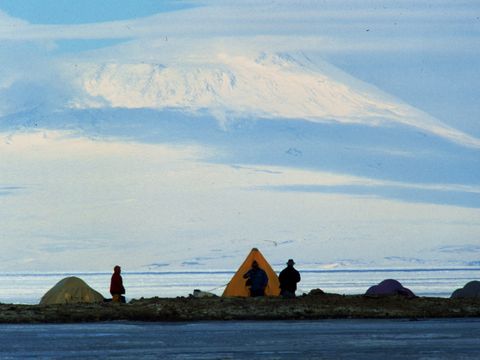
1999-017-Camp-site-at-Marble-Point-with-Mt-Erebus-backdrop.jpg

1999-018-Camp-site-at-Marble-Point-with-Mt-Erebus-backdrop.jpg

1999-022-Skua-chick-nest-at-Marble-Point.jpg
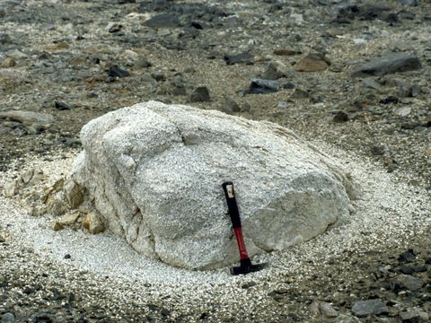
1999-023-A-weathering-boulder-at-Marble-Point.jpg

1999-025-Zeolite-deposit-at-Marble-Point.jpg

1999-026-Zeolite-deposit-at-Marble-Point.jpg

1999-028-Zeolite-deposit-at-Marble-Point.jpg

1999-029-Zeolite-material-at-Marble-Point.jpg

1999-033-Soil-pit-for-installation-of-the-soil-temperature-stack-and-moisture-measuring-sensors-for-long-term-soil-climate-measurements-Marble-Point.jpg

1999-039-Camp-site-at-Marble-Point.jpg

1999-040-R-Paetzold-at-the-Marble-Point-soil-climate-monitoring-site.jpg

1999-049-View-Marble-Point-McMurdo-Sound-Mt-Erebus-from-the-Wilson-Piedmont-Glacier.jpg

1999-051-View-Marble-Point-McMurdo-Sound-Mt-Erebus-from-the-Wilson-Piedmont-Glacier.jpg

1999-054-J-Kimble-at-a-contaminated-soil-monitoring-site-at-Marble-Point.jpg

1999-055-Engine-oil-contaminated-monitoring-site-at-Marble-Point.jpg
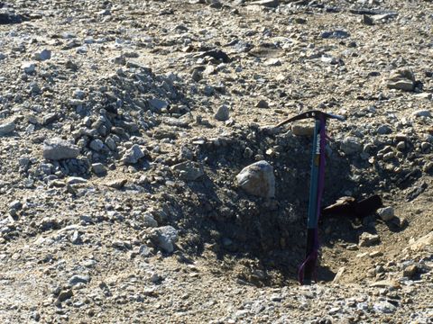
1999-057-An-old-soil-pit-site-at-Marble-Point.jpg

1999-059-Energy-expensive-waste-water-reduction-by-heating-evaporation-at-Marble-Point-refueling-facility.jpg
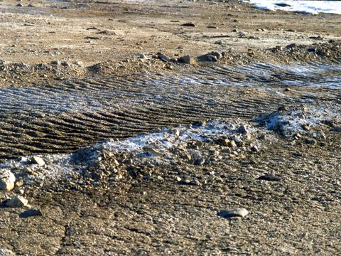
1999-060-Fresh-vehicle-tracks-at-Marble-Point.jpg

1999-065-Vehicle-tracks-at-Marble-Point.jpg

1999-068-Wilson-Piedmont-Glacier-and-a-small-lake-dam-at-Marble-Point.jpg

1999-069-R-Paetzold-J-Kimble-M-Balks-D-Sheppard-at-Marble-point-camp-site.jpg

1999-073-1950s-land-disturbance-and-salinization-at-Marble-Point.jpg

1999-083-A-Moss-patch-at-Marble-Point.jpg

1999-084-D-Saul-J-Kimble-M-Balks-R-Paetzold-D-Sheppard-at-the-Marble-Point-soil-climate-station-site.jpg

1999-085-J-Kimble-R-Paetzold-M-Balks-at-the-Bull-Pass-soil-climate-station-site.jpg

1999-088-Capilliary-moisture-movement-along-cracks-in-a-boulder.jpg

1999-089-Footprints-in-soft-soil-near-Bull-Pass.jpg
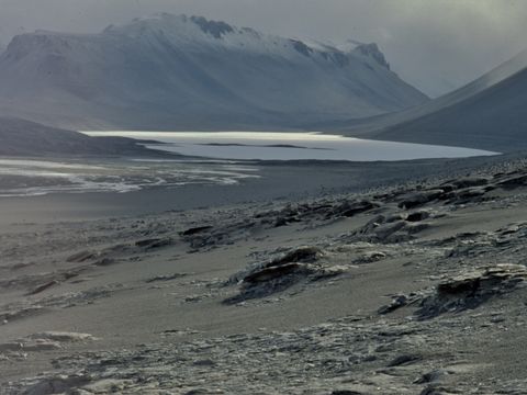
1999-090-View-of-Lake-Vanda-from-near-Bull-Pass.jpg

1999-092-Footprints-in-sand-at-Bull-Pass.jpg

1999-093-View-of-Lake-Vanda-from-Bull-Pass.jpg

1999-094-M-Balks-on-valley-floor-near-Bull-Pass.jpg

1999-096-Bull-Pass-seismograph-site.jpg

1999-098-M-Balks-J-Kimble-at-the-Bull-Pass-soil-climate-monitoring-station-establishment.jpg
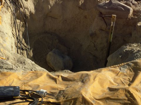
1999-099-Dry-frozen-soil-pit-for-installing-soil-climate-monitoring-equipment-at-Bull-Pass.jpg

1999-100-J-Kimble-R-Paetzold-at-the-Bull-Pass-soil-climate-station-establishment.jpg

1999-103-Wright-Valley-floor-near-Lake-Vanda.jpg

1999-105-Footsteps-in-gravel-near-Bull-Pass.jpg
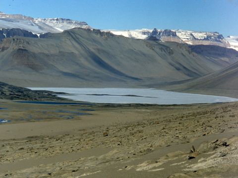
1999-106-View-of-Lake-Vanda-from-above-Bull-Pass.jpg

1999-108-Gully-formation-in-Bull-Pass.jpg

1999-109-Rock-weathering-at-Bull-Pass.jpg

1999-110-J-Kimble-M-Balks-among-gneissic-rocks-at-Bull-Pass.jpg
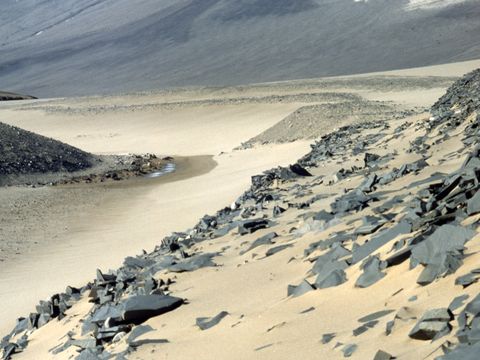
1999-118-Sand-deposits-in-Bull-Pass.jpg

1999-119-M-Balks-J-Kimble-in-a-gully-above-Bull-Pass.jpg

1999-124-Footprints-in-a-sand-deposit-at-Bull-Pass.jpg

1999-127-Wright-Valley-floor-east-of-Bull-Pass.jpg

1999-128-M-Balks-on-the-Wright-Valley-floor-east-of-Bull-Pass.jpg

1999-129-M-Balks-by-Bartley-Glacier-Lower-Wright-Valley.jpg

1999-131-Bartley-Glacier-Lower-Wright-valley.jpg

1999-138-M-Balks-on-patterned-ground-near-Bartley-Glacier-Wright-Valley.jpg

1999-139-Onyx-River-in-full-flow-13th-Jan-1999.jpg

1999-140-D-Sheppard-M-Balks-D-Saul-unknown-J-Kimble-R-Paetzold-at-Bull-Pass-hut.jpg

1999-141-Tent-camp-at-Bull-Pass.jpg

1999-145-Wind-fluted-pitted-sandstone-rock-with-desert-varnish-at-Sessrumnir-Valley-Asgard-Range.jpg

1999-146-Wind-fluted-sandstone-rocks-at-Sessrumnir-Valley-Asgard-Range.jpg

1999-147-Bull-Pass-sand-accumulation-and-oasis.jpg

1999-151-Wright-Upper-Glacier-ice-falls.jpg

1999-153-R-Paetzold-J-Kimble-B-Hallet-R-Sletten-unknown-at-Sessrumnir-Valley-Asgard-Range.jpg

1999-154-Weathering-pattern-on-a-sandstone-boulder-surface-Sessrumnir-Valley.jpg

1999-155-Endolithic-algae-in-sandstone-rock-Sessrumnir-Valley-Asgard-Range.jpg

1999-163-Aerial-view-Labyrinth-and-Wright-Valley.jpg

1999-174-Aerial-view-Mt-Aeolus-Olympus-Range.jpg

1999-177-Aerial-view-Lake-Vida.jpg

1999-179-Patterned-ground-near-Lake-Vida.jpg

1999-180-Aerial-View-McKelvey-Valley.jpg

1999-181-Aerial-view-Barwick-Valley-Olympus-Range.jpg

1999-182-Aerial-view-Barwick-Valley-and-Olympus-Range.jpg

1999-184-Aerial-view-of-Lake-Vanda.jpg

1999-185-Soil-climate-station-at-Bull-Pass.jpg

1999-186-J-Kimble-R-Paetzold-Unknown-D-Saul-D-Sheppard-M-Balks-at-Bull-Pass.jpg

1999-188-Aerial-view-lower-Wright-Valley.jpg

1999-192-Scott-Base-permafrost-experiment-site-showing-ground-shrinkage.jpg

1999-193-Herc-landing-at-Williams-Field.jpg

1999-195-Herc-taxiing-at-Williams-Field.jpg

1999-196-McMurdo-Station-land-instability.jpg

1999-197-McMurdo-Station-storage-area.jpg

1999-199-The-ice-wharf-at-McMurdo-Station.jpg

1999-200-Scott-Base-and-the-Ross-Ice-Shelf.jpg

1999-201-McMurdo-Station-storage-area.jpg

1999-203-McMurdo-Station-and-unstable-land-on-hill-slopes.jpg

1999-204-I-Campbell-on-Ross-Island.jpg
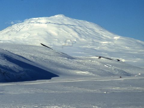
1999-205-View-of-Mt-Erebus.jpg

1999-210-Crevassed-terrain-on-the-foot-slopes-of-Mt-Erebus.jpg

1999-211-Hercs-at-Williams-field.jpg

1999-212-M-Balks-on-departure-for-NZ.jpg

1999-DEC-009-Mt-Erebus-view.jpg

1999-DEC-012-Scott-Base-from-the-sea-ice.jpg
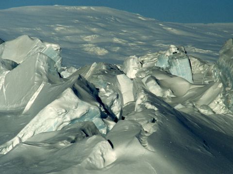
1999-DEC-015-Pressure-ridges-at-Scott-Base.jpg
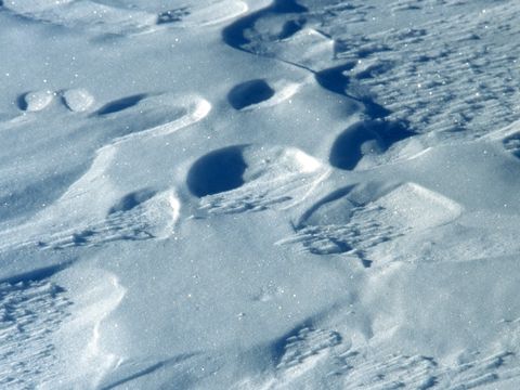
1999-DEC-017-Snow-surface-patterns.jpg

1999-DEC-020-Unknown-person-irrigating-soil-at-cones-at-a-nematode-experimental-site-Lake-Hoare.jpg
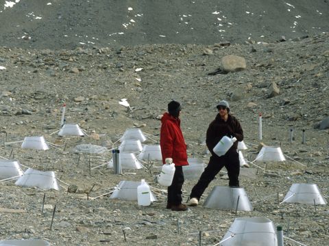
1999-DEC-022-Unknown-US-scientists-at-a-nematode-experimental-site-Lake-Hoare.jpg

1999-DEC-023-Soil-nematode-experimental-site-with-soil-warming-cones-Lake-Hoare.jpg

1999-DEC-024-I-Campbell-at-a-soil-sampling-site-near-Lake-Hoare.jpg

1999-DEC-026-Soil-moisture-loss-sampling-site-near-Lake-Hoare.jpg

1999-DEC-028-Inspection-of-an-old-drill-site-fuel-leak-at-Lake-Vida.jpg

1999-DEC-029-Helo-landed-at-Lake-Vida.jpg
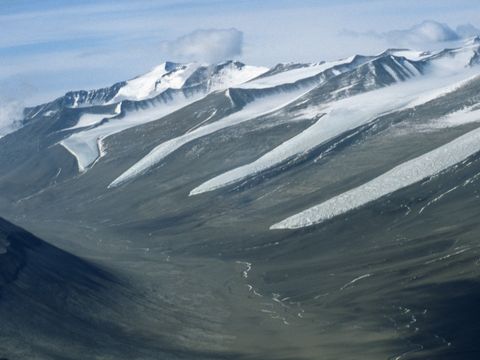
1999-DEC-030-Aerial-view-of-Lower-Wright-Valley.jpg

1999-DEC-033-Aerial-view-of-Taylor-Glacier-terminus.jpg
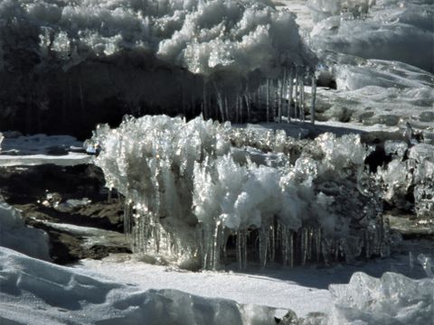
1999-DEC-041-Ice-features-on-Lake-Hoare.jpg

1999-DEC-049-The-soil-datalogger-recording-site-on-the-upper-terrace-near-Lake-Hoare.jpg

1999-DEC-051-Lacroix-glacier.jpg
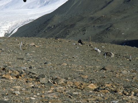
1999-DEC-054-A-soil-sampling-pit-site-at-the-upper-terrace-nematode-experimental-area.jpg
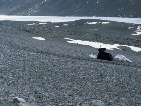
1999-DEC-057-A-soil-sampling-pit-site-at-a-nematode-experimental-area-Lake-Hoare.jpg

1999-DEC-058-Canada-Glacier-margin-at-Lake-Hoare.jpg
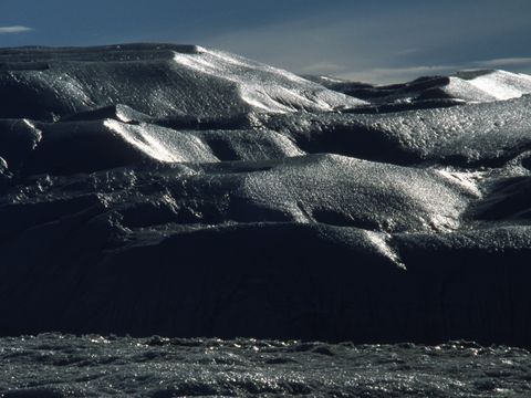
1999-DEC-063-Canada-Glacier-with-wind-eroded-ice.jpg

1999-DEC-066-A-soil-sample-pit-site-at-a-nematode-experimental-area-Lake-Hoare.jpg

1999-DEC-068-A-soil-sample-pit-site-at-a-nematode-experimental-area-Lake-Hoare.jpg
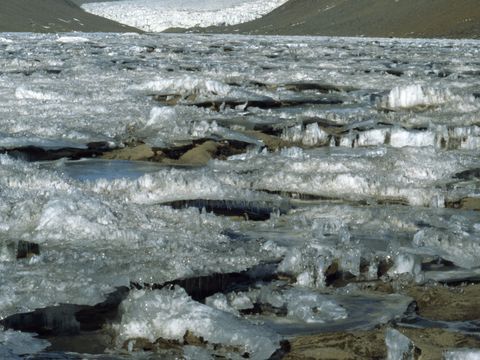
1999-DEC-071-The-ice-surface-at-lake-Hoare.jpg
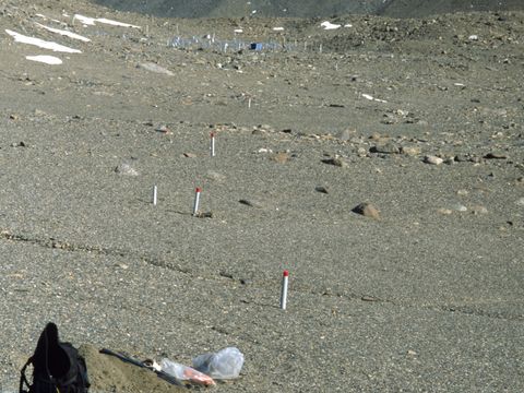
1999-DEC-074-A-soil-sample-pit-at-a-nematode-experimental-site-Lake-Hoare.jpg

1999-DEC-085-Canada-Glacier-margin-at-Lake-Hoare.jpg

1999-DEC-089-Lake-Hoare-field-camp-by-the-Canada-Glacier.jpg

1999-DEC-090-A-Soil-sample-site-on-Andrews-Ridge.jpg

1999-DEC-092-I-Campbell-soil-sampling-at-a-nematode-experimental-site-Lake-Hoare.jpg
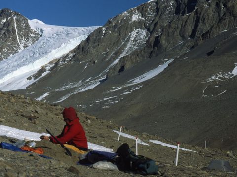
1999-DEC-093-I-campbell-soil-sampling-at-a-nematode-experimental-site-at-Lake-Hoare.jpg

1999-DEC-095-Soil-moisture-loss-measurement-site-near-lake-Hoare.jpg

1999-DEC-096-I-Campbell-soil-sampling-at-a-nematode-experimental-site-Lake-Hoare.jpg

1999-DEC-098-Thawing-at-the-edge-of-a-snow-drift.jpg

1999-DEC-099-A-wind-fluted-boulder-near-Lake-Hoare.jpg

1999-DEC-103-A-seal-carcass-on-the-valley-side-above-Lake-Hoare.jpg
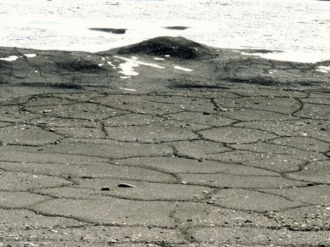
1999-DEC-104-patterned-ground-formation-on-tills-near-Lake-Hoare.jpg

1999-DEC-108-Lacroix-Glacier-and-head-of-Lake-Hoare.jpg

1999-DEC-109-Lower-Taylor-Valley-view-from-Andrews-Ridge-Canada-Commonwealth-Glaciers.jpg

1999-DEC-111-Lower-Taylor-Valley-view-from-Andrews-Ridge-Canada-Commonwealth-Glaciers.jpg

1999-DEC-113-Soil-nematode-experimental-plot-and-soil-sampling-site.jpg

1999-DEC-114-Evidence-of-boulder-movement-on-Andrews-Ridge.jpg

1999-DEC-115-Cliff-face-basement-rock-exposure-near-lake-Hoare.jpg
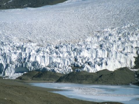
1999-DEC-116-Lacroix-Glacier-margin.jpg

1999-DEC-117-Site-for-soil-moisture-loss-measurements-near-lake-Hoare.jpg

1999-DEC-120-An-old-tent-site-near-Lacroix-Glacier.jpg

1999-DEC-125-Multiple-patterned-ground-cracking.jpg

1999-DEC-127-Ice-features-on-the-surface-of-Lake-Hoare.jpg

1999-DEC-128-Ice-features-on-the-ssurface-of-Lake-Hoare.jpg

1999-DEC-135-Fractured-dark-coloured-rock.jpg

1999-DEC-137-Site-for-measuring-soil-water-loss-after-snow-retreat.jpg

1999-DEC-139-Exfoliaating-granite-rock-on-side-slope-of-Andrews-Ridge.jpg

1999-DEC-140-A-fractured-boulder-on-side-slope-of-Andrews-Ridge.jpg

1999-DEC-141-Down-slope-movement-of-soil-material-on-side-of-Andrews-Ridge.jpg

1999-DEC-142-Fractured-rock-on-side-slope-of-Andrews-ridge.jpg

1999-DEC-145-Rock-fracturing-weathering-on-side-slope-of-Andrews-ridge.jpg

1999-DEC-147-Bedrock-weathering-on-Andrews-Ridge.jpg

1999-DEC-152-3-metre-granite-erratics-on-Taylor-Ridge.jpg
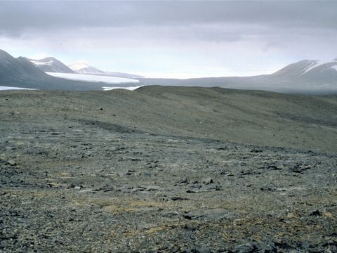
1999-DEC-155-View-of-soil-pit-site-on-Andrews-Ridge.jpg

1999-DEC-162-Green-algae-beneath-quartzite-stones-near-Lake-Hoare.jpg

1999-DEC-163-Inside-the-field-lab-with-soil-samples-for-processing.jpg
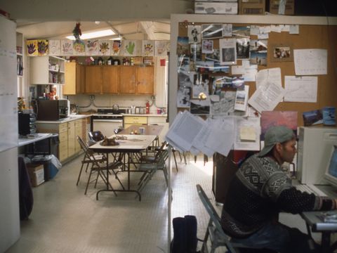
1999-DEC-165-Inside-the-main-building-at-Lake-Hoare-field-station.jpg

1999-DEC-166-Lake-Hoare-field-station-and-Canada-Glacier.jpg

1999-DEC-169-Upper-Taylor-Glacier-Pearce-Valley-with-Round-Mountain-and-St-Pauls-Mountain-beyond.jpg

1999-DEC-172-Upper-Taylor-Glacier-area-Pearce-Valley-and-Round-Mountain.jpg
1999-DEC-175-Soil-descriptipon-and-sampling-site-at-Beacon-Valley.jpg
1999-DEC-178-Unknown-biologists-collecting-soil-samples-to-look-for-nematodes-at-Beacon-Valley.jpg
1999-DEC-180-A-soil-description-sampling-site-in-Beacon-Valley.jpg
1999-DEC-182-I-Campbell-D-Wall-R-Virginia-and-others-at-Beacon-Valley-nematode-inspection.jpg

1999-DEC-190-Upper-Taylor-Glacier-area.jpg
1999-DEC-195-View-of-Upper-Taylor-Glacier-from-Beacon-Valley.jpg

1999-DEC-200-Lake-Hoare-surface-and-Lacroix-Glacier.jpg

1999-DEC-204-helo-landing-near-lake-Hoare.jpg

1999-DEC-205-Datalogger-soil-temperature-measuring-site-on-the-terrace-Lake-Hoare.jpg

1999-DEC-206-Upper-Taylor-Glacier-near-Knobhead.jpg
1999-DEC-208-Beacon-Valley-departure-and-unknown-US-biologists.jpg

1999-DEC-212-I-Campbell-near-Lacroix-Glacier.jpg
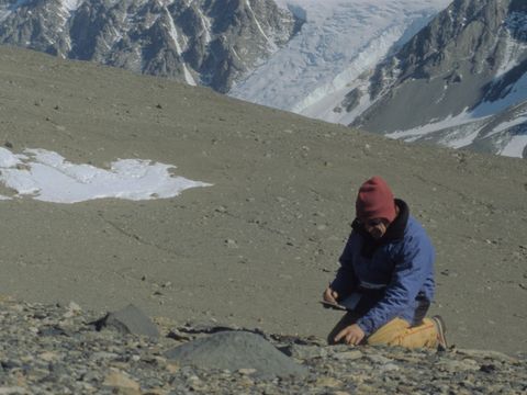
1999-DEC-213-I-Campbell-describing-soil-on-Andrews-Ridge.jpg

1999-DEC-214-Differential-cavernous-weathering-on-a-boulder.jpg

1999-DEC-215-Taylor-Ridge-Taylor-Valley.jpg

1999-DEC-216-Lacroix-Glacier-Taylor-Valley.jpg

1999-DEC-218-A-former-soil-surface-disturbance-near-Lake-Hoare.jpg
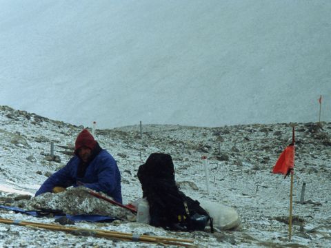
1999-DEC-220-I-Campbell-near-Lake-Hoare-soil-sampling.jpg

1999-DEC-223-Cavernously-weathered-gneissic-boulder-Andrews-Ridge.jpg

1999-DEC-224-Lower-Taylor-Valley-from-Taylor-Ridge.jpg
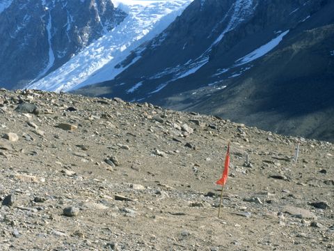
1999-DEC-226-Nematode-work-site-identification.jpg

1999-DEC-227-Lake-Hoare-field-station.jpg
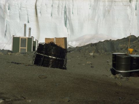
1999-DEC-228-Waste-for-removal-at-Lake-Hoare-camp.jpg

1999-DEC-229-Canada-Glacier-at-Lake-Hoare.jpg

1999-DEC-230-Lake-Hoare-field-camp-Canada-Glacier.jpg

1999-DEC-232-Lake-Hoare-field-camp-and-Canada-Glacier.jpg

1999-DEC-233-The-power-source-for-lake-Hoare-field-station.jpg

1999-DEC-234-Iain-Campbell-last-day-in-the-field-at-Lake-Hoare-camp.jpg

1999-DEC-235-Emperor-penguin-on-sea-ice-McMurdo-Sound.jpg